קובץ:תמונת לווין-הים התיכון.JPG
אין גרסה ברזולוציה גבוהה יותר.
תמונת_לווין-הים_התיכון.JPG (529 × 269 פיקסלים, גודל הקובץ: 33 ק"ב, סוג MIME: image/jpeg)
| זהו קובץ שמקורו במיזם ויקישיתוף. תיאורו בדף תיאור הקובץ המקורי (בעברית) מוצג למטה. |
תקציר
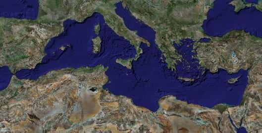
| תיאור | Satellite caption of the Mediterranean Sea |
| תאריך יצירה | |
| מקור | Screenshot from NASA World Wind (retouched) |
| יוצר | of the modification : Eric Gaba (RonenY) |
| אישורים והיתרים (שימוש חוזר בקובץ זה) |
All rights released |
| גרסאות אחרות |
blank with State borders : Image:Mediterranean_Sea_political_map-blank.svg ; with caption in English : Image:Mediterranean_Sea_political_map-en.svg ; with caption in French : Image:Mediterranean_Sea_political_map-fr.svg |
רישיון
| קובץ זה בנחלת הכלל כי הוא צילום מסך מתוכנת תוכנת הגלובוס של נאס"א, שעושה שימוש במרכיבים שנמצאים ברשות הציבור כמו: The Blue Marble, MODIS, Landsat, SRTM, USGS או GLOBE.
|
 |
| This work was previously under Public Domain, or a Free License. It has been digitally enhanced and/or modified. This derivative work has been (or is hereby) released into the public domain by its author, Sting at the French Wikipedia project. This applies worldwide. In some countries this is not legally possible; if so:
|
רישיון
| קובץ זה בנחלת הכלל כי הוא צילום מסך מתוכנת תוכנת הגלובוס של נאס"א, שעושה שימוש במרכיבים שנמצאים ברשות הציבור כמו: The Blue Marble, MODIS, Landsat, SRTM, USGS או GLOBE.
|
|
היסטוריית הקובץ
ניתן ללחוץ על תאריך/שעה כדי לראות את הקובץ כפי שנראה באותו זמן.
| תאריך/שעה | תמונה ממוזערת | ממדים | משתמש | הערה | |
|---|---|---|---|---|---|
| נוכחית | 05:09, 30 ביולי 2007 | | 269 × 529 (33 ק"ב) | RonenY~commonswiki | == Summary == {{Information |Description=Satellite caption of the Mediterranean Sea |Source=Screenshot from NASA World Wind (retouched) |Date=30 June 2007 |Author=of the modification : Eric Gaba (RonenY) |Permissi |
שימוש בקובץ
הדף הבא משתמש בקובץ הזה:
שימוש גלובלי בקובץ
אתרי הוויקי השונים הבאים משתמשים בקובץ זה:
- שימוש באתר it.wikiquote.org