קובץ:DGPS Reference Station.jpg
גודל התצוגה המקדימה הזאת: 505 × 600 פיקסלים. רזולוציות אחרות: 202 × 240 פיקסלים | 404 × 480 פיקסלים.
לקובץ המקורי (800 × 950 פיקסלים, גודל הקובץ: 101 ק"ב, סוג MIME: image/jpeg)
| זהו קובץ שמקורו במיזם ויקישיתוף. תיאורו בדף תיאור הקובץ המקורי (בעברית) מוצג למטה. |
| תיאור |
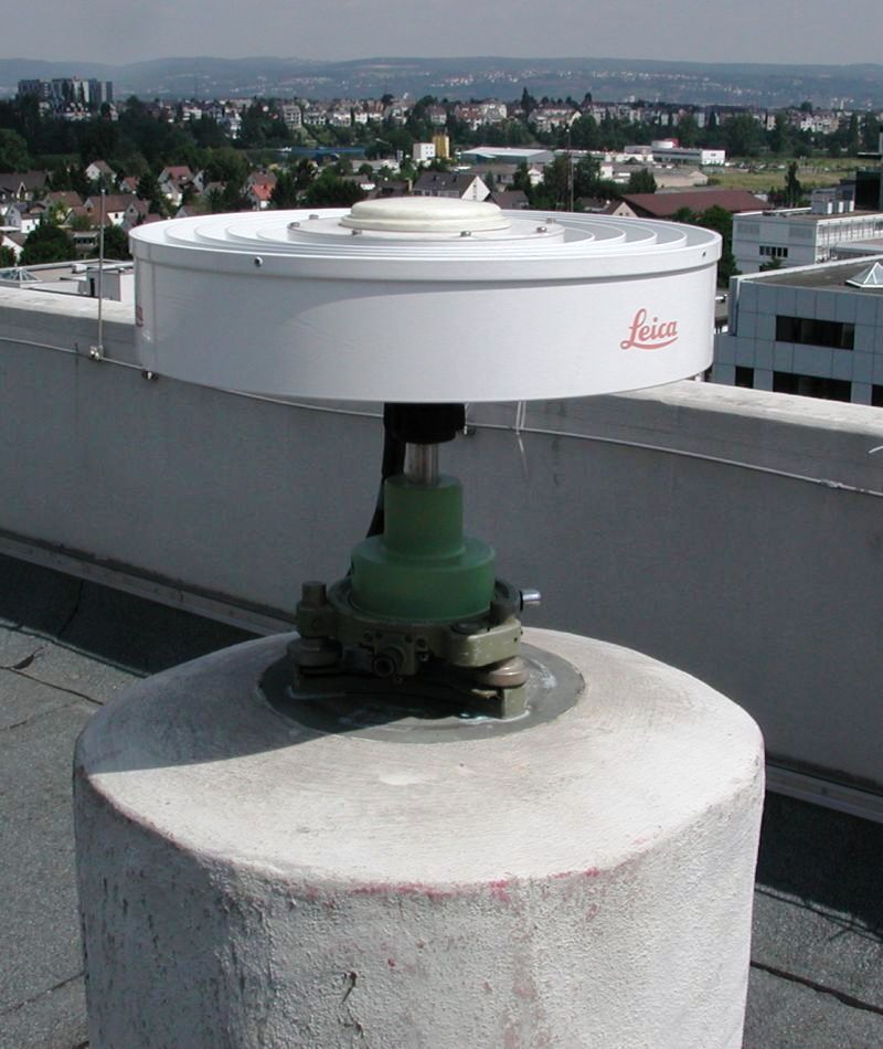
Deutsch: Eine DGPS-Referenzstation auf dem Dach des Landesamts für Vermessung und Geobasisinformation Rheinland-Pfalz (LVermGeo RP). Das LVermGeo RP ist für das Gebiet von Rheinland-Pfalz Betreiber des Satellitenpositionierungsdienstes der Deutschen Landesvermessung (SAPOS).
Español: Estación de referencia DGPS
English: DGPS Reference Station |
||||||||
| תאריך יצירה | |||||||||
| מקור |
נוצר על־ידי מעלה היצירה (Stefan Kühn) English: Transferred from de.wikipedia.org [1]: 2003-07-19 09:18 . . Stefan Kühn . . 800×950 (106121 bytes) |
||||||||
| יוצר | Stefan Kühn | ||||||||
| אישורים והיתרים (שימוש חוזר בקובץ זה) |
Stefan Kühn, בעל זכויות היוצרים על היצירה הזאת, מפרסם אותה בזאת תחת הרישיון הבא:
|

![[1]](https://de.wikipedia.org/w/index.php?title=File%3ADGPS-Referenzstation.jpg)
| מיקום המצלמה | | תמונה זו ותמונות נוספות במיקום: OpenStreetMap |
|---|
היסטוריית הקובץ
ניתן ללחוץ על תאריך/שעה כדי לראות את הקובץ כפי שנראה באותו זמן.
| תאריך/שעה | תמונה ממוזערת | ממדים | משתמש | הערה | |
|---|---|---|---|---|---|
| נוכחית | 11:58, 7 באוגוסט 2007 | | 950 × 800 (101 ק"ב) | Tony Rotondas | {{Information |Description= {{de|**Bild einer DGPS-Referenzstation auf dem Dach des Landesamts für Vermessung und Geobasisinformation Rheinland-Pfalz (LVermGeo RP). Das LVermGeo RP ist für das Gebiet von Rheinland-Pfalz Betreiber des Satellitenpositioni |
שימוש בקובץ
הדף הבא משתמש בקובץ הזה:
שימוש גלובלי בקובץ
אתרי הוויקי השונים הבאים משתמשים בקובץ זה:
- שימוש באתר ar.wikipedia.org
- שימוש באתר ca.wikipedia.org
- שימוש באתר cs.wikipedia.org
- שימוש באתר de.wikipedia.org
- שימוש באתר en.wikipedia.org
- שימוש באתר es.wikipedia.org
- שימוש באתר fi.wikipedia.org
- שימוש באתר it.wikipedia.org
- שימוש באתר lv.wikipedia.org
- שימוש באתר oc.wikipedia.org
- שימוש באתר ru.wikipedia.org
- שימוש באתר sk.wikipedia.org
- שימוש באתר sr.wikipedia.org
- שימוש באתר uk.wikipedia.org
- שימוש באתר www.wikidata.org