קובץ:Operation frantic map.png
אין גרסה ברזולוציה גבוהה יותר.
Operation_frantic_map.png (750 × 564 פיקסלים, גודל הקובץ: 167 ק"ב, סוג MIME: image/png)
| זהו קובץ שמקורו במיזם ויקישיתוף. תיאורו בדף תיאור הקובץ המקורי (בעברית) מוצג למטה. |
תקציר
| תיאור |
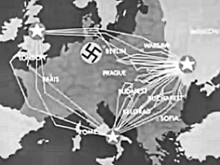
English: Frame shot of routes taken by USAAF strategic bombers during "Operation Frantic", the shuttle bombing missions between England, Italy and the Soviet Union, 1944. |
| תאריך יצירה | |
| מקור | Operation Titanic, United States War Department Film, Produced by the Army Pictorial Service (Signal Corps), in conjunction with the Army Air Forces, 1945 |
| יוצר | United States War Department |
| אישורים והיתרים (שימוש חוזר בקובץ זה) |
USGOV-PD |
רישיון
This image or file is a work of a U.S. Air Force Airman or employee, taken or made as part of that person's official duties. As a work of the U.S. federal government, the image or file is in the public domain in the United States.
|
 |
היסטוריית הקובץ
ניתן ללחוץ על תאריך/שעה כדי לראות את הקובץ כפי שנראה באותו זמן.
| תאריך/שעה | תמונה ממוזערת | ממדים | משתמש | הערה | |
|---|---|---|---|---|---|
| נוכחית | 18:28, 13 באפריל 2011 | | 564 × 750 (167 ק"ב) | SamOdin | small fix |
| 19:44, 29 באפריל 2010 |  | 564 × 750 (175 ק"ב) | Bwmoll3 | {{Information |Description={{en|1=Frame shot of routes taken by USAAF strategic bombers during "Operation Frantic", the shuttle bombing missions between England, Italy and the Soviet Union, 1944.}} |Source=Operation Titanic, United States War Department |
שימוש בקובץ
הדף הבא משתמש בקובץ הזה:
שימוש גלובלי בקובץ
אתרי הוויקי השונים הבאים משתמשים בקובץ זה:
- שימוש באתר de.wikipedia.org
- שימוש באתר en.wikipedia.org
- שימוש באתר fr.wikipedia.org
- שימוש באתר id.wikipedia.org
- שימוש באתר ro.wikipedia.org
- שימוש באתר ru.wikipedia.org
- שימוש באתר uk.wikipedia.org
- שימוש באתר www.wikidata.org