קובץ:USGS orthophoto of North Brother Island and South Brother Island - Bronx County.png

גודל התצוגה המקדימה הזאת: 308 × 600 פיקסלים. רזולוציות אחרות: 123 × 240 פיקסלים | 246 × 480 פיקסלים | 846 × 1,648 פיקסלים.
לקובץ המקורי (846 × 1,648 פיקסלים, גודל הקובץ: 1.77 מ"ב, סוג MIME: image/png)
| זהו קובץ שמקורו במיזם ויקישיתוף. תיאורו בדף תיאור הקובץ המקורי (בעברית) מוצג למטה. |
תקציר
| תיאור | |
| תאריך יצירה | Acquired in march 2006; published by USGS in 2008; converted and uploaded to Commons on April 22, 2009. |
| מקור |
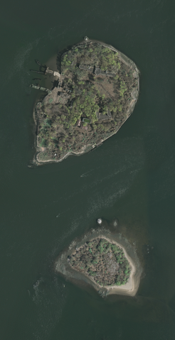
The National Map Seamless Server, layer New York City (Mar 2006), latitude 40.79433919 to 40.80337576, longitude -73.90149724 to -73.89540822. Converted from GeoTIFF to PNG using GIMP. |
| יוצר | U.S. Geological Survey, conversion to PNG by uploader (Herr Satz). |
רישיון
This image is in the public domain in the United States because it only contains materials that originally came from the United States Geological Survey, an agency of the United States Department of the Interior. For more information, see the official USGS copyright policy.
|
היסטוריית הקובץ
ניתן ללחוץ על תאריך/שעה כדי לראות את הקובץ כפי שנראה באותו זמן.
| תאריך/שעה | תמונה ממוזערת | ממדים | משתמש | הערה | |
|---|---|---|---|---|---|
| נוכחית | 20:04, 22 באפריל 2009 | | 1,648 × 846 (1.77 מ"ב) | Herr Satz | {{Information |Description={{en|1=Orthophoto of North Brother and South Brother islands.}} |Source=[http://gisdata.usgs.net/website/seamless/viewer.htm ''The National Map'' Seamless Se |
שימוש בקובץ
הדפים הבאים משתמשים בקובץ הזה:
שימוש גלובלי בקובץ
אתרי הוויקי השונים הבאים משתמשים בקובץ זה:
- שימוש באתר de.wikipedia.org
- שימוש באתר es.wikipedia.org
- שימוש באתר et.wikipedia.org
- שימוש באתר fr.wikipedia.org