קובץ:Ancestral Puebloan sites.png
גודל התצוגה המקדימה הזאת: 521 × 599 פיקסלים. רזולוציות אחרות: 209 × 240 פיקסלים | 417 × 480 פיקסלים | 913 × 1,050 פיקסלים.
לקובץ המקורי (913 × 1,050 פיקסלים, גודל הקובץ: 82 ק"ב, סוג MIME: image/png)
| זהו קובץ שמקורו במיזם ויקישיתוף. תיאורו בדף תיאור הקובץ המקורי (בעברית) מוצג למטה. |
תקציר
| תיאור |
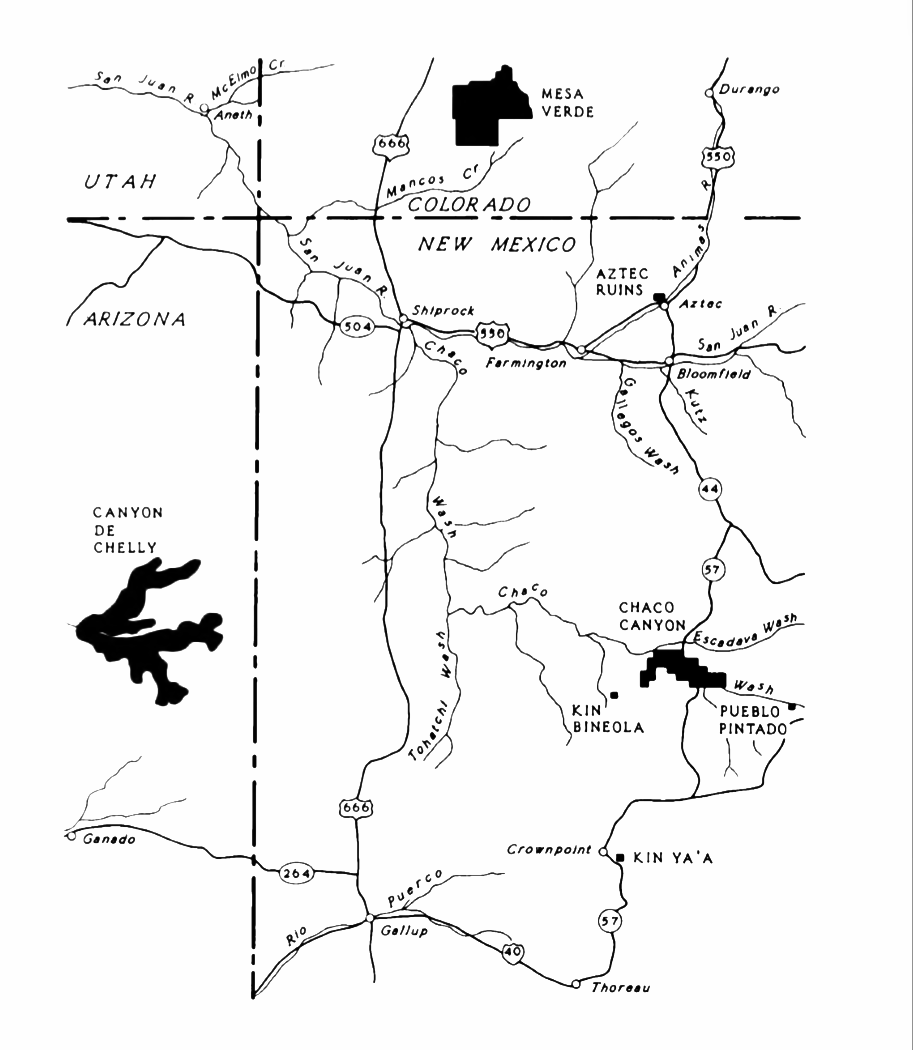
English: An NPS map of Ancestral Puebloan sites in the Four Corners area. |
| תאריך יצירה | |
| מקור | Lyons, Thomas R., Remote Sensing Experiments in Cultural Resource Studies: Non-destructive Methods of Archeological Exploration, Survey, and Analysis, Reports of the Chaco Center, No. 1, United States Department of the Interior, National Park Service, page 104. |
| יוצר | National Park Service |
רישיון
| This image or media file contains material based on a work of a National Park Service employee, created as part of that person's official duties. As a work of the U.S. federal government, such work is in the public domain in the United States. See the NPS website and NPS copyright policy for more information. |
היסטוריית הקובץ
ניתן ללחוץ על תאריך/שעה כדי לראות את הקובץ כפי שנראה באותו זמן.
| תאריך/שעה | תמונה ממוזערת | ממדים | משתמש | הערה | |
|---|---|---|---|---|---|
| נוכחית | 07:32, 1 במרץ 2016 | | 1,050 × 913 (82 ק"ב) | Hotshot977 | Increased contrast and converted to greyscale color space. |
| 22:14, 3 ביוני 2015 |  | 1,050 × 913 (450 ק"ב) | Rationalobserver | User created page with UploadWizard |
שימוש בקובץ
הדף הבא משתמש בקובץ הזה:
שימוש גלובלי בקובץ
אתרי הוויקי השונים הבאים משתמשים בקובץ זה:
- שימוש באתר en.wikipedia.org
- שימוש באתר es.wikipedia.org
- שימוש באתר fr.wikipedia.org