קובץ:Argentina Entre Ríos location map.svg

גודל התצוגה המקדימה הזאת מסוג PNG של קובץ ה־SVG הזה: 417 × 600 פיקסלים. רזולוציות אחרות: 167 × 240 פיקסלים | 334 × 480 פיקסלים | 534 × 768 פיקסלים | 712 × 1,024 פיקסלים | 1,423 × 2,048 פיקסלים | 570 × 820 פיקסלים.
לקובץ המקורי (קובץ SVG, הגודל המקורי: 570 × 820 פיקסלים, גודל הקובץ: 380 ק"ב)
| זהו קובץ שמקורו במיזם ויקישיתוף. תיאורו בדף תיאור הקובץ המקורי (בעברית) מוצג למטה. |
תקציר
| תיאור |
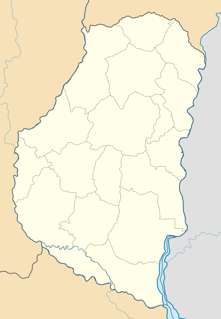
Deutsch: Positionskarte von Entre Ríos (Argentinien) English: Location map of Entre Ríos province (Argentina) Español: Mapa de localización de la Provincia de Entre Ríos.
Equirectangular projection, N/S stretching 115 %. Geographic limits of the map:
|
| תאריך יצירה | (UTC) |
| מקור |
קובץ זה הוא יצירה נגזרת של: |
| יוצר |
|
| גרסאות אחרות |
|

רישיון
הקובץ הזה מתפרסם לפי תנאי רישיון קריאייטיב קומונז ייחוס-שיתוף זהה 3.0 לא מותאם.
- הנכם רשאים:
- לשתף – להעתיק, להפיץ ולהעביר את העבודה
- לערבב בין עבודות – להתאים את העבודה
- תחת התנאים הבאים:
- ייחוס – יש לתת ייחוס הולם, לתת קישור לרישיון, ולציין אם נעשו שינויים. אפשר לעשות את זה בכל צורה סבירה, אבל לא בשום צורה שמשתמע ממנה שמעניק הרישיון תומך בך או בשימוש שלך.
- שיתוף זהה – אם תיצרו רמיקס, תשנו, או תבנו על החומר, חובה עליכם להפיץ את התרומות שלך לפי תנאי רישיון זהה או תואם למקור.
יומן העלאה מקורי
This image is a derivative work of the following images:
- File:Argentina_location_map.svg licensed with Cc-by-sa-3.0, GFDL
- File:Map_of_Entre_Rios_Province.svg licensed with Cc-by-sa-3.0,2.5,2.0,1.0, GFDL
Uploaded with derivativeFX
היסטוריית הקובץ
ניתן ללחוץ על תאריך/שעה כדי לראות את הקובץ כפי שנראה באותו זמן.
| תאריך/שעה | תמונה ממוזערת | ממדים | משתמש | הערה | |
|---|---|---|---|---|---|
| נוכחית | 05:55, 10 בספטמבר 2017 | | 820 × 570 (380 ק"ב) | Milenioscuro | capas |
| 01:50, 10 ביולי 2013 |  | 820 × 570 (584 ק"ב) | Milenioscuro | == {{int:filedesc}} == {{Information |Description={{de|Positionskarte von Entre Ríos (Argentinien)}}{{en|Location map of Entre Ríos province (Argentina)}}{{es|1=Mapa de localización de la Provincia de Entre Río... |
שימוש בקובץ
הדפים הבאים משתמשים בקובץ הזה:
שימוש גלובלי בקובץ
אתרי הוויקי השונים הבאים משתמשים בקובץ זה:
- שימוש באתר de.wikipedia.org
- שימוש באתר en.wikipedia.org
- שימוש באתר eo.wikipedia.org
- שימוש באתר es.wikipedia.org
- Victoria (Entre Ríos)
- Crespo (Argentina)
- Libertador San Martín
- Puiggari
- Gualeguay
- Basavilbaso
- Concordia (Argentina)
- Paraná (Argentina)
- Villa Elisa (Entre Ríos)
- Gualeguaychú
- La Paz (Entre Ríos)
- Concepción del Uruguay
- Villaguay
- Urdinarrain
- Nogoyá
- Chajarí
- Colón (Entre Ríos)
- Rosario del Tala
- Oro Verde (Argentina)
- Federación (Argentina)
- Mandisoví
- Diamante (Argentina)
- San Salvador (Entre Ríos)
- San José (Entre Ríos)
- Bovril (Argentina)
- San Benito (Entre Ríos)
- Villa Paranacito
- Ibicuy
- Federal (Entre Ríos)
- San José de Feliciano
- Santa Elena (Entre Ríos)
- Walter Moss
- General Campos
- María Grande
- Paso de la Arena (Argentina)
- Cerrito (Entre Ríos)
- Lucas González (localidad)
- Aldea San Antonio (Gualeguaychú)
- Aldea San Juan
- General Ramírez