קובץ:Armenia Topography he.JPG

גודל התצוגה המקדימה הזאת: 607 × 599 פיקסלים. רזולוציות אחרות: 243 × 240 פיקסלים | 486 × 480 פיקסלים | 778 × 768 פיקסלים | 1,037 × 1,024 פיקסלים | 1,930 × 1,906 פיקסלים.
לקובץ המקורי (1,930 × 1,906 פיקסלים, גודל הקובץ: 2.97 מ"ב, סוג MIME: image/jpeg)
| זהו קובץ שמקורו במיזם ויקישיתוף. תיאורו בדף תיאור הקובץ המקורי (בעברית) מוצג למטה. |
תקציר
| תיאור |
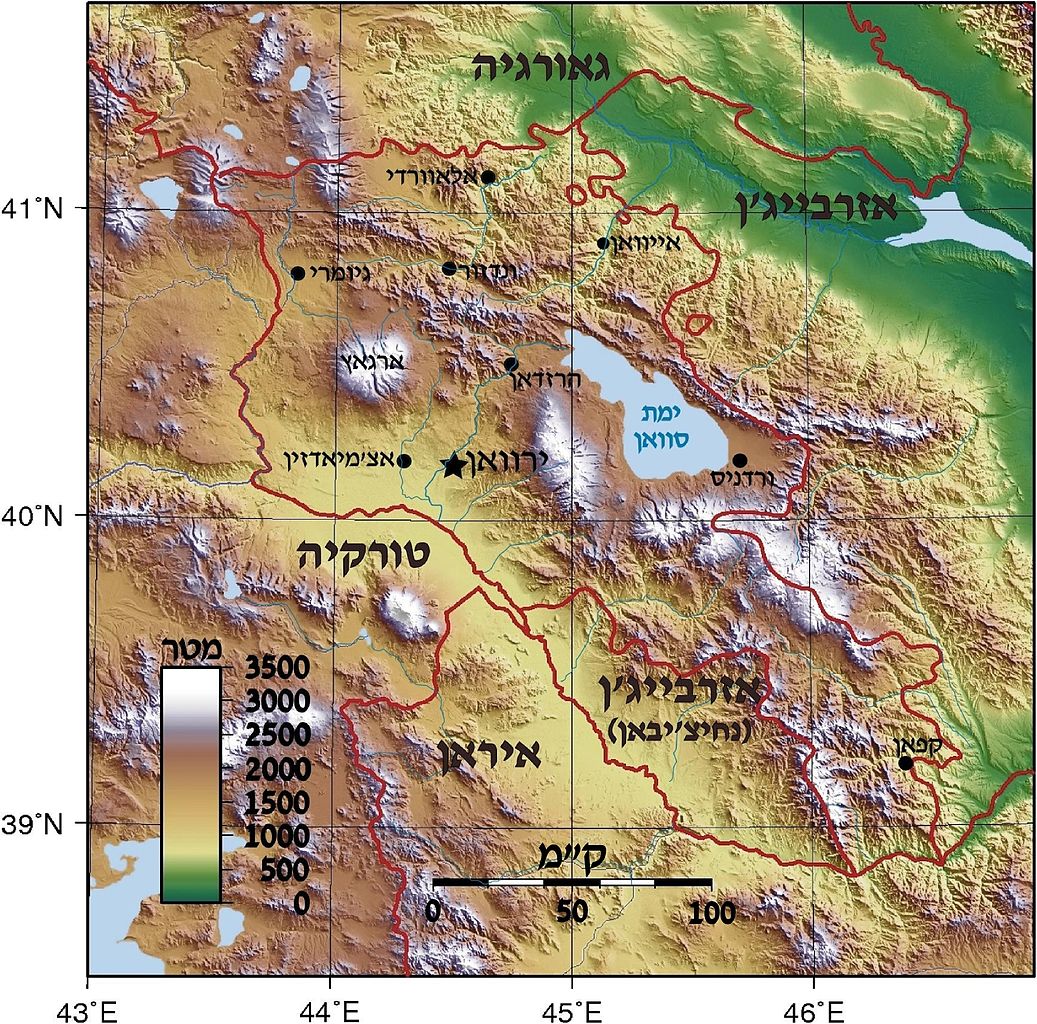
Topographic map of Armenia. Created with GMT from SRTM data Deutsch: Positionskarte von Armenien. Quadratische Plattkarte, N-S-Streckung 130 %. Geographische Begrenzung der Karte: * N: 41.4° N * S: 38.8° N * W: 43.4° O * O: 46.7° O English: Location map of Armenia. Equirectangular projection, N/S stretching 130 %. Geographic limits of the map: * N: 41.4° N * S: 38.8° N * W: 43.4° E * E: 46.7° E Français : Carte administrative muette de l'Arménie. Projection cylindrique équidistante, avec étirement nord-sud de 130%. Limites de la carte : * N: 41,4° * O: 43,4° * S: 38,8° * E: 46,7° |
| תאריך יצירה | (UTC) |
| מקור |
קובץ זה הוא יצירה נגזרת של: |
| יוצר |
|


| זוהי תמונה מרוטשת, זאת אומרת שהתמונה שונתה בצורה דיגיטלית מהמקור. Modifications: Armenia Topography in hebrew. את התמונה המקורית ניתן לראות ב: Am-map he.svg.
|
רישיון
הקובץ הזה מתפרסם לפי תנאי רישיון קריאייטיב קומונז ייחוס-שיתוף זהה 3.0 לא מותאם.
- הנכם רשאים:
- לשתף – להעתיק, להפיץ ולהעביר את העבודה
- לערבב בין עבודות – להתאים את העבודה
- תחת התנאים הבאים:
- ייחוס – יש לתת ייחוס הולם, לתת קישור לרישיון, ולציין אם נעשו שינויים. אפשר לעשות את זה בכל צורה סבירה, אבל לא בשום צורה שמשתמע ממנה שמעניק הרישיון תומך בך או בשימוש שלך.
- שיתוף זהה – אם תיצרו רמיקס, תשנו, או תבנו על החומר, חובה עליכם להפיץ את התרומות שלך לפי תנאי רישיון זהה או תואם למקור.
יומן העלאה מקורי
This image is a derivative work of the following images:
- File:Armenia_Topography.png licensed with Cc-by-sa-3.0,2.5,2.0,1.0, GFDL
- 2007-09-01T17:58:04Z Sadalmelik 1318x1305 (3158922 Bytes) {{Information |Description=Topographic map of Armenia. Created with GMT from SRTM data |Source=self-made |Date=Sep 1, 2007 |Author= [[User:Sadalmelik|Sadalmelik]] }} [[Category:Maps of Armenia]] [[Category:Topographic maps o
- File:Am-map_he.svg licensed with Cc-by-sa-3.0
- 2012-07-29T13:44:12Z Amirki 1169x1198 (321353 Bytes) הוספת מקרא
- 2012-07-29T13:13:36Z Amirki 1169x1198 (288011 Bytes) object to path
- 2012-07-29T13:11:17Z Amirki 1169x1198 (208116 Bytes) == {{int:filedesc}} == {{Information |Description={{Multilingual description |de= Positionskarte von [[:de:Armenien|Armenien]]. Quadratische Plattkarte, N-S-Streckung 130 %. Geographische Begrenzung der Karte: * N: 41.4° N *
Uploaded with derivativeFX
היסטוריית הקובץ
ניתן ללחוץ על תאריך/שעה כדי לראות את הקובץ כפי שנראה באותו זמן.
| תאריך/שעה | תמונה ממוזערת | ממדים | משתמש | הערה | |
|---|---|---|---|---|---|
| נוכחית | 18:54, 29 ביולי 2012 | | 1,906 × 1,930 (2.97 מ"ב) | Amirki | . |
| 18:23, 29 ביולי 2012 |  | 1,715 × 1,737 (736 ק"ב) | Amirki | . | |
| 18:03, 29 ביולי 2012 |  | 1,715 × 1,737 (2.76 מ"ב) | Amirki | == {{int:filedesc}} == {{Information |Description=Topographic map of Armenia. Created with GMT from SRTM data {{Multilingual description |de= Positionskarte von Armenien.<br> Quadratische Plattkarte, N-S-Streckung 130 %. Geographische ... |
שימוש בקובץ
הדפים הבאים משתמשים בקובץ הזה: