קובץ:Bishopric of Strasbourg 1547.png

Bishopric_of_Strasbourg_1547.png (536 × 522 פיקסלים, גודל הקובץ: 599 ק"ב, סוג MIME: image/png)
| זהו קובץ שמקורו במיזם ויקישיתוף. תיאורו בדף תיאור הקובץ המקורי (בעברית) מוצג למטה. |
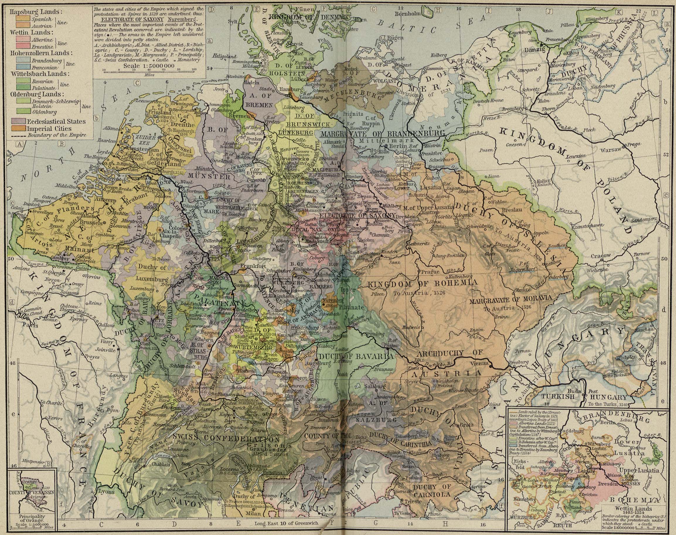
| תיאור | Modern map showing the Bishopric of Strasbourg and part of the Rhineland circa 1547 | ||||||
| תאריך יצירה | (UTC) | ||||||
| מקור | Cropped from Central Europe about 1547, from The Historical Atlas by William R. Shepherd, 1923 | ||||||
| יוצר | OwenBlacker | ||||||
| אישורים והיתרים (שימוש חוזר בקובץ זה) |
|
||||||
היסטוריית הקובץ
ניתן ללחוץ על תאריך/שעה כדי לראות את הקובץ כפי שנראה באותו זמן.
| תאריך/שעה | תמונה ממוזערת | ממדים | משתמש | הערה | |
|---|---|---|---|---|---|
| נוכחית | 15:22, 16 בספטמבר 2007 | | 522 × 536 (599 ק"ב) | OwenBlacker | {{Information |Description=Map of the w:Bishopric of Strasbourg, circa 1547 |Source=Cropped from [http://www.lib.utexas.edu/maps/historical/shepherd/central_europe_1547.jpg Central Europe about 1547], from ''The Historical Atlas'' by William R. Sheph |
שימוש בקובץ
הדף הבא משתמש בקובץ הזה:
שימוש גלובלי בקובץ
אתרי הוויקי השונים הבאים משתמשים בקובץ זה:
- שימוש באתר ca.wikipedia.org
- שימוש באתר cs.wikipedia.org
- שימוש באתר de.wikipedia.org
- שימוש באתר en.wikipedia.org
- שימוש באתר es.wikipedia.org
- שימוש באתר fr.wikipedia.org
- שימוש באתר it.wikipedia.org
- שימוש באתר ru.wikipedia.org
- שימוש באתר sh.wikipedia.org
- שימוש באתר vi.wikipedia.org
- שימוש באתר www.wikidata.org