קובץ:EWR Airport Diagram.svg

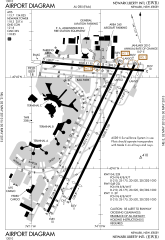
גודל התצוגה המקדימה הזאת מסוג PNG של קובץ ה־SVG הזה: 378 × 548 פיקסלים. רזולוציות אחרות: 165 × 240 פיקסלים | 331 × 480 פיקסלים | 530 × 768 פיקסלים | 706 × 1,024 פיקסלים | 1,413 × 2,048 פיקסלים.
לקובץ המקורי (קובץ SVG, הגודל המקורי: 378 × 548 פיקסלים, גודל הקובץ: 874 ק"ב)
| זהו קובץ שמקורו במיזם ויקישיתוף. תיאורו בדף תיאור הקובץ המקורי (בעברית) מוצג למטה. |
תקציר
| תיאור |
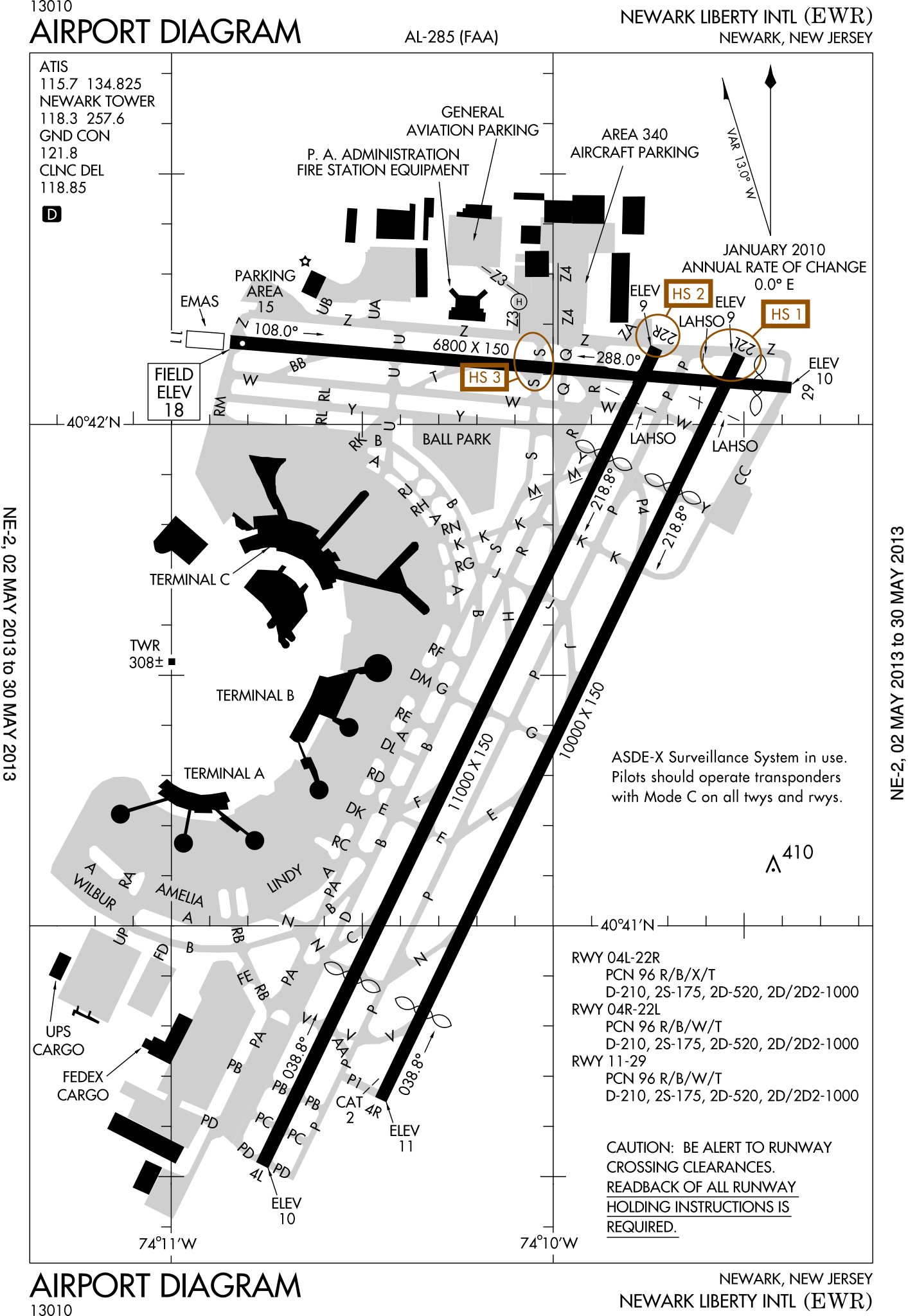
English: FAA Airport Diagram of Newark Liberty International Airport. |
| תאריך יצירה | |
| מקור |
FAA Airport Diagrams; note that these change every 28 days. Taken from PDF on FAA site and converted to SVG using en:Wikipedia:How to draw SVG circuits using Xcircuit. |
| יוצר | Produced by the National Aeronautical Charting Office (NACO), a department of the United States en:Federal Aviation Administration. |
| מיקום המצלמה | | תמונה זו ותמונות נוספות במיקום: OpenStreetMap |
|---|
W3C-validity not checked.
רישיון
This image or file is a work of a Federal Aviation Administration employee, taken or made as part of that person's official duties. As a work of the U.S. federal government, the image is in the public domain in the United States.
|
 |
היסטוריית הקובץ
ניתן ללחוץ על תאריך/שעה כדי לראות את הקובץ כפי שנראה באותו זמן.
| תאריך/שעה | תמונה ממוזערת | ממדים | משתמש | הערה | |
|---|---|---|---|---|---|
| נוכחית | 16:23, 2 במאי 2013 | | 548 × 378 (874 ק"ב) | Grendelkhan | SVG version of FAA's PDF diagram. |
שימוש בקובץ
הדף הבא משתמש בקובץ הזה:
שימוש גלובלי בקובץ
אתרי הוויקי השונים הבאים משתמשים בקובץ זה:
- שימוש באתר da.wikipedia.org
- שימוש באתר de.wikipedia.org
- שימוש באתר en.wikipedia.org
- שימוש באתר fi.wikipedia.org
- שימוש באתר fr.wikipedia.org
- שימוש באתר id.wikipedia.org
- שימוש באתר ja.wikipedia.org
- שימוש באתר mr.wikipedia.org
- שימוש באתר no.wikipedia.org
- שימוש באתר pl.wikipedia.org
- שימוש באתר ru.wikipedia.org
- שימוש באתר sv.wikipedia.org
- שימוש באתר th.wikipedia.org