קובץ:Provincia Margarita.jpg
לקובץ המקורי (4,592 × 3,152 פיקסלים, גודל הקובץ: 10.88 מ"ב, סוג MIME: image/jpeg)
| זהו קובץ שמקורו במיזם ויקישיתוף. תיאורו בדף תיאור הקובץ המקורי (בעברית) מוצג למטה. |
תקציר
| תיאור |
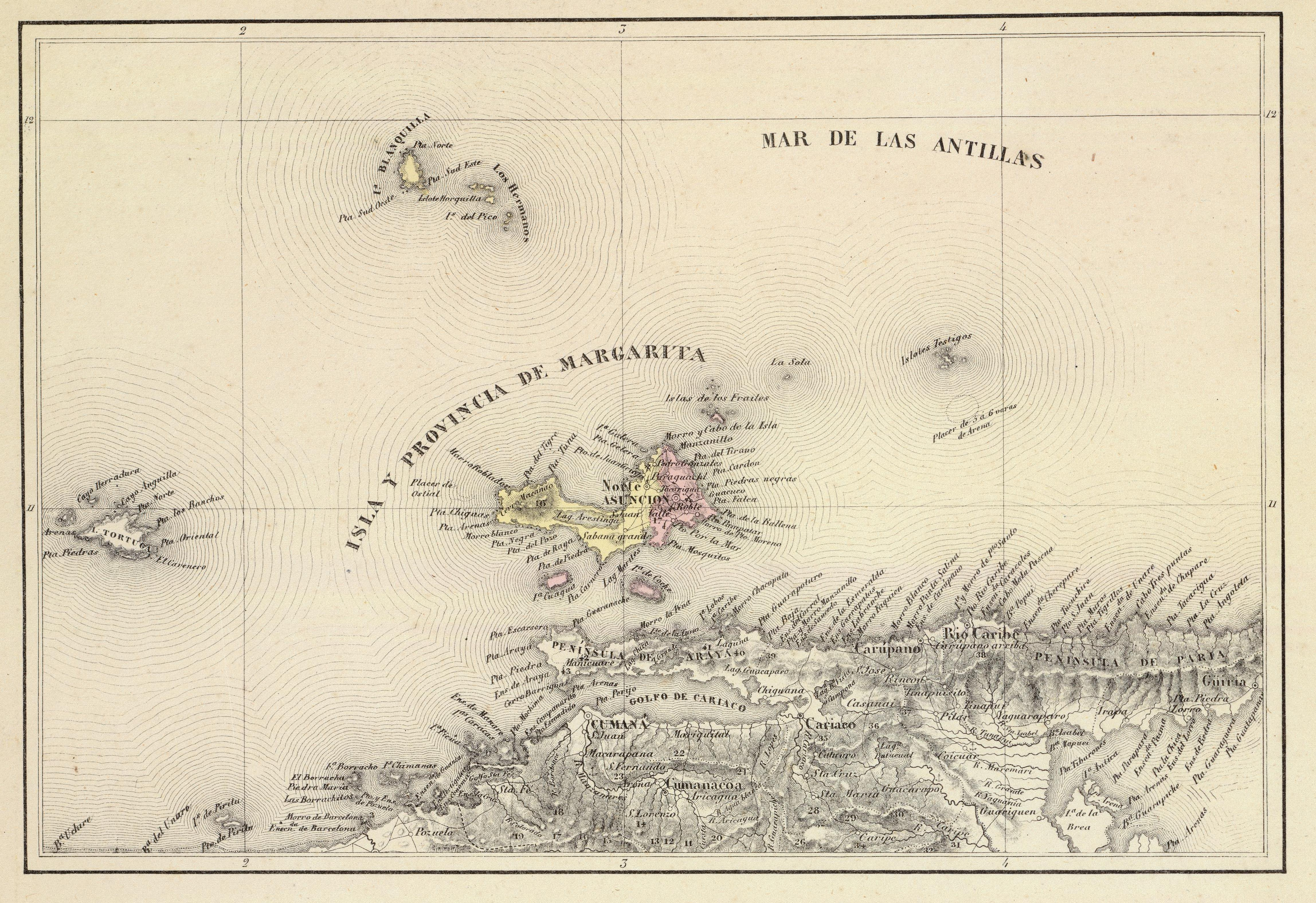
Español: Provincia de Margarita. Tomado del "Atlas físico y político de la República de Venezuela", 1840. |
||||||||||||||||||||
| תאריך יצירה | |||||||||||||||||||||
| מקור | Historical Maps by Agustín Codazzi, from David Rumsey Website | ||||||||||||||||||||
| יוצר |
|
||||||||||||||||||||

רישיון
|
יצירה זו נמצאת בנחלת הכלל במדינת המקור ובמדינות אחרות בהם תקופת זכויות היוצרים היא משך חיי היוצר ו-70 שנה (או פחות) מפטירתו.
| |
| הקובץ הזה זוהה כקובץ חופשי מכל מגבלה ידועה תחת חוק זכויות היוצרים, כולל כל הזכויות הקשורות והסמוכות. | |
היסטוריית הקובץ
ניתן ללחוץ על תאריך/שעה כדי לראות את הקובץ כפי שנראה באותו זמן.
| תאריך/שעה | תמונה ממוזערת | ממדים | משתמש | הערה | |
|---|---|---|---|---|---|
| נוכחית | 18:07, 15 בנובמבר 2015 | | 3,152 × 4,592 (10.88 מ"ב) | Wilfredor | more size |
| 06:58, 10 בינואר 2009 |  | 777 × 1,129 (282 ק"ב) | Milenioscuro | {{Information |Description={{es|1=Provincia de Margarita. Tomado del "Atlas físico y político de la República de Venezuela", 1840.}} |Source=[http://www.davidrumsey.com/directory/who/Codazzi++Agustin++1793+1859/ Historical Maps by Agustín Codazzi, fro |
שימוש בקובץ
הדף הבא משתמש בקובץ הזה:
שימוש גלובלי בקובץ
אתרי הוויקי השונים הבאים משתמשים בקובץ זה:
- שימוש באתר el.wikipedia.org
- שימוש באתר en.wikipedia.org
- שימוש באתר es.wikipedia.org
- שימוש באתר fr.wikipedia.org
- שימוש באתר hy.wikipedia.org
- שימוש באתר it.wikipedia.org
- שימוש באתר sv.wikipedia.org
- שימוש באתר www.wikidata.org