קובץ:Saint-Martin collectivity location map.svg

גודל התצוגה המקדימה הזאת מסוג PNG של קובץ ה־SVG הזה: 800 × 578 פיקסלים. רזולוציות אחרות: 320 × 231 פיקסלים | 640 × 462 פיקסלים | 1,024 × 740 פיקסלים | 1,280 × 925 פיקסלים | 2,560 × 1,850 פיקסלים | 1,175 × 849 פיקסלים.
לקובץ המקורי (קובץ SVG, הגודל המקורי: 1,175 × 849 פיקסלים, גודל הקובץ: 182 ק"ב)
| זהו קובץ שמקורו במיזם ויקישיתוף. תיאורו בדף תיאור הקובץ המקורי (בעברית) מוצג למטה. |
תקציר
| מיקום המצלמה | | תמונה זו ותמונות נוספות במיקום: OpenStreetMap |
|---|
| תיאור |
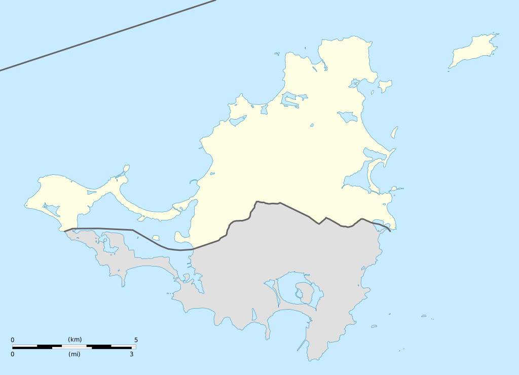
English: Blank administrative map of the overseas collectivity of Saint Martin, France, for geo-location purpose.
Français : Carte administrative vierge de la collectivité d'outre-mer de Saint-Martin, France, destinée à la géolocalisation. Estimated scale: 1:200,000 (precision: 50 m)
Geographic limits of the map:
|
||
| תאריך יצירה | |||
| מקור |
נוצר על־ידי מעלה היצירה
|
||
| יוצר | Eric Gaba (Sting - fr:Sting) | ||
| אישורים והיתרים (שימוש חוזר בקובץ זה) |
|
||
| גרסאות אחרות |
|


רישיון
אני, בעל זכויות היוצרים על היצירה הזאת, מפרסם אותה בזאת תחת הרישיונות הבאים:
הקובץ הזה מתפרסם לפי תנאי רישיון קריאייטיב קומונז ייחוס-שיתוף זהה 3.0 לא מותאם.
- הנכם רשאים:
- לשתף – להעתיק, להפיץ ולהעביר את העבודה
- לערבב בין עבודות – להתאים את העבודה
- תחת התנאים הבאים:
- ייחוס – יש לתת ייחוס הולם, לתת קישור לרישיון, ולציין אם נעשו שינויים. אפשר לעשות את זה בכל צורה סבירה, אבל לא בשום צורה שמשתמע ממנה שמעניק הרישיון תומך בך או בשימוש שלך.
- שיתוף זהה – אם תיצרו רמיקס, תשנו, או תבנו על החומר, חובה עליכם להפיץ את התרומות שלך לפי תנאי רישיון זהה או תואם למקור.

|
מוענקת בכך הרשות להעתיק, להפיץ או לשנות את המסמך הזה, לפי תנאי הרישיון לשימוש חופשי במסמכים של גנו, גרסה 1.2 או כל גרסה מאוחרת יותר שתפורסם על־ידי המוסד לתוכנה חופשית; ללא פרקים קבועים, ללא טקסט עטיפה קדמית וללא טקסט עטיפה אחורית. עותק של הרישיון כלול בפרק שכותרתו הרישיון לשימוש חופשי במסמכים של גנו. |
הנכם מוזמנים לבחור את הרישיון הרצוי בעיניכם.
היסטוריית הקובץ
ניתן ללחוץ על תאריך/שעה כדי לראות את הקובץ כפי שנראה באותו זמן.
| תאריך/שעה | תמונה ממוזערת | ממדים | משתמש | הערה | |
|---|---|---|---|---|---|
| נוכחית | 22:42, 17 בינואר 2009 | | 849 × 1,175 (182 ק"ב) | Sting | == Summary == {{Location|18|04|07|N|63|03|45|W|scale:100000}} <br/> {{Information |Description={{en|Blank administrative map of the overseas collectivity of Saint Martin, France, f |
שימוש בקובץ
הדפים הבאים משתמשים בקובץ הזה:
שימוש גלובלי בקובץ
אתרי הוויקי השונים הבאים משתמשים בקובץ זה:
- שימוש באתר af.wikipedia.org
- שימוש באתר als.wikipedia.org
- שימוש באתר an.wikipedia.org
- שימוש באתר ar.wikipedia.org
- שימוש באתר ast.wikipedia.org
- שימוש באתר be-tarask.wikipedia.org
- שימוש באתר bg.wikipedia.org
- שימוש באתר bn.wikipedia.org
- שימוש באתר bs.wikipedia.org
- שימוש באתר ceb.wikipedia.org
- Plantilya:Location map Saint-Martin
- Green Cay
- Eastern Point
- Red Hill
- Bell Point
- Flagstaff
- Saint-Martin (pagklaro)
- Île Frégate
- Red Rock
- Hope Hill
- Bell Hill
- Pointe Noire
- Marigot
- Le Paradis
- Baie Rouge
- Crocus Hill
- Île Charlotte
- Lac Simpson
- Lac Simson
- Montagne Ronde
- Pointe Bluff
- Pointe Nord
- Saint Martin (pagklaro)
- La Selle
- Mont Fortune
- Baie du Marigot
- Grand Îlet
- Morne Rond
- Le Selle
- Simson Baai Lagoen
- Sint Maarten (pagklaro)
- Pointe Falaise
- Pointe du Bluff
- Spaniard Rock
- Baie Blanche
- Concordia Hill
- Mont des Accords