קובץ:1933 HMS Norfolk Summer cruise map.jpg

גודל התצוגה המקדימה הזאת: 377 × 599 פיקסלים. רזולוציות אחרות: 151 × 240 פיקסלים | 302 × 480 פיקסלים | 483 × 768 פיקסלים | 644 × 1,024 פיקסלים | 1,289 × 2,048 פיקסלים | 4,171 × 6,627 פיקסלים.
לקובץ המקורי (4,171 × 6,627 פיקסלים, גודל הקובץ: 3.62 מ"ב, סוג MIME: image/jpeg)
| זהו קובץ שמקורו במיזם ויקישיתוף. תיאורו בדף תיאור הקובץ המקורי (בעברית) מוצג למטה. |
תקציר
| תיאור |
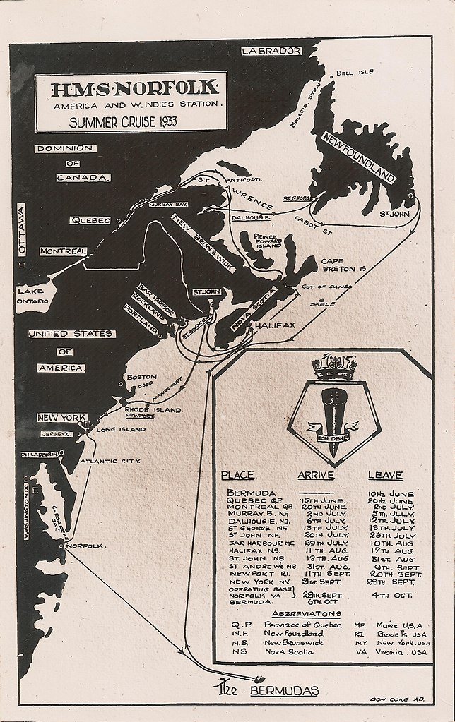
English: A map of the 1933 summer cruise of HMS Norfolk, beginning and ending at its base at the Royal Naval Dockyard on Ireland Island in Bermuda. Visits were made to various ports in Dominion of Canada, the Dominion of Newfoundland, and the United States of America. |
| תאריך יצירה | |
| מקור | Self-scanned |
| יוצר | AB Don Coke, Royal Navy |
רישיון
This work created by the United Kingdom Government is in the public domain.
This is because it is one of the following:
HMSO has declared that the expiry of Crown Copyrights applies worldwide (ref: HMSO Email Reply)
|
 |
היסטוריית הקובץ
ניתן ללחוץ על תאריך/שעה כדי לראות את הקובץ כפי שנראה באותו זמן.
| תאריך/שעה | תמונה ממוזערת | ממדים | משתמש | הערה | |
|---|---|---|---|---|---|
| נוכחית | 17:33, 30 בינואר 2021 | | 6,627 × 4,171 (3.62 מ"ב) | Aodhdubh | Uploaded a work by AB Don Coke, Royal Navy from Scan from original with UploadWizard |
שימוש בקובץ
הדף הבא משתמש בקובץ הזה:
שימוש גלובלי בקובץ
אתרי הוויקי השונים הבאים משתמשים בקובץ זה:
- שימוש באתר en.wikipedia.org