קובץ:Anguilla location map.svg

גודל התצוגה המקדימה הזאת מסוג PNG של קובץ ה־SVG הזה: 664 × 599 פיקסלים. רזולוציות אחרות: 266 × 240 פיקסלים | 532 × 480 פיקסלים | 851 × 768 פיקסלים | 1,134 × 1,024 פיקסלים | 2,269 × 2,048 פיקסלים | 1,777 × 1,604 פיקסלים.
לקובץ המקורי (קובץ SVG, הגודל המקורי: 1,777 × 1,604 פיקסלים, גודל הקובץ: 56 ק"ב)
| זהו קובץ שמקורו במיזם ויקישיתוף. תיאורו בדף תיאור הקובץ המקורי (בעברית) מוצג למטה. |
תקציר
| תיאור |
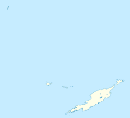
Deutsch: Positionskarte von Anguilla
Geographische Begrenzung der Karte:
English: Location map of Anguilla
Geographic limits of the map:
|
||||||||||||
| תאריך יצירה | |||||||||||||
| מקור | נוצר על־ידי מעלה היצירה | ||||||||||||
| יוצר | NordNordWest | ||||||||||||
| אישורים והיתרים (שימוש חוזר בקובץ זה) |
|
||||||||||||
| גרסאות אחרות | Derivative works of this file: Anguilla islands.svg |

|
This map has been made or improved in the German Kartenwerkstatt (Map Lab). You can propose maps to improve as well.
|
היסטוריית הקובץ
ניתן ללחוץ על תאריך/שעה כדי לראות את הקובץ כפי שנראה באותו זמן.
| תאריך/שעה | תמונה ממוזערת | ממדים | משתמש | הערה | |
|---|---|---|---|---|---|
| נוכחית | 21:34, 3 במאי 2010 | | 1,604 × 1,777 (56 ק"ב) | NordNordWest | == {{int:filedesc}} == {{Information |Description= {{de|Positionskarte von Anguilla}} Geographische Begrenzung der Karte: * N: 18.62° N * S: 18.14° N * W: 63.46° W * O: 62.90° W {{en|Location map of Anguilla}} Geograp |
שימוש בקובץ
הדפים הבאים משתמשים בקובץ הזה:
שימוש גלובלי בקובץ
אתרי הוויקי השונים הבאים משתמשים בקובץ זה:
- שימוש באתר af.wikipedia.org
- שימוש באתר an.wikipedia.org
- שימוש באתר ar.wikipedia.org
- שימוש באתר ast.wikipedia.org
- שימוש באתר ba.wikipedia.org
- שימוש באתר be.wikipedia.org
- שימוש באתר bg.wikipedia.org
- שימוש באתר bs.wikipedia.org
- שימוש באתר ceb.wikipedia.org
- Anguilla
- Gumagamit:Lsj/Test
- Plantilya:Location map United Kingdom Anguilla
- Sandy Island
- Long Bay
- Great Bay
- Shoal Bay
- West Point
- West Cay
- Sandy Point
- Long Rock
- Little Island
- Blowing Rock
- Windward Point
- Warner Point
- The Valley
- Valley
- Stoney Bay
- Spring Bay
- Sombrero (pagklaro)
- Hat Island
- Sombrero Island
- Snake Point
- Lovers Point
- Seal Rocks
- Seal Island
- Seal Islets
- Seal Islands
- Scrub Island
- Scrub Islet
- Savannah Bay
- Sand Island
- Sandy Hill Bay
- Road Point
- Road Bay
- North Side