קובץ:Bukowina Donaumonarchie.png
אין גרסה ברזולוציה גבוהה יותר.
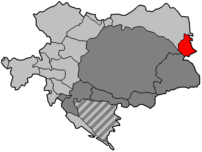
Bukowina_Donaumonarchie.png (674 × 510 פיקסלים, גודל הקובץ: 7 ק"ב, סוג MIME: image/png)
| זהו קובץ שמקורו במיזם ויקישיתוף. תיאורו בדף תיאור הקובץ המקורי (בעברית) מוצג למטה. |

|
יש ליצור מחדש את התמונה map הזו באמצעות גרפיקה וקטורית כדוגמת קובץ SVG. לפעולה זו מספר יתרונות, כפי שניתן לקרוא (באנגלית) בדף Commons:Media for cleanup. אם ברשותכם קובץ SVG, אנא העלו אותו. לאחר מכן, החליפו תבנית זו בתבנית
{{vector version available|שם הקובץ.svg}} |
תקציר
| תיאור |
English: Map of Austria-Hungary |
| תאריך יצירה | |
| מקור | נוצר על־ידי מעלה היצירה |
| יוצר | Immanuel Giel |
רישיון
| ברצוני, בעלי זכויות היוצרים על יצירה זו, לשחרר יצירה זו לנחלת הכלל. זה תקף בכל העולם. יש מדינות שבהן הדבר אינו אפשרי על פי חוק, אם כך: אני מעניק לכל אחד את הזכות להשתמש בעבודה זו לכל מטרה שהיא, ללא תנאים כלשהם, אלא אם כן תנאים כאלה נדרשים על פי חוק. |
היסטוריית הקובץ
ניתן ללחוץ על תאריך/שעה כדי לראות את הקובץ כפי שנראה באותו זמן.
| תאריך/שעה | תמונה ממוזערת | ממדים | משתמש | הערה | |
|---|---|---|---|---|---|
| נוכחית | 14:48, 28 בספטמבר 2021 | | 510 × 674 (7 ק"ב) | Sumek101 | Bug fix: Fiume was part of Transleithania. Bosnia and Herzegovina was under dually administration by Cisleithania and Transleithania |
| 11:11, 12 בינואר 2009 |  | 510 × 674 (8 ק"ב) | Immanuel Giel | {{Information |Description={{en|1=Map of Austria-Hungary}} |Source=Own work by uploader |Author=Immanuel Giel |Date=January 2009 |Permission= |other_versions= }} <!--{{ImageUpload|full}}--> Category:Maps of Austria-Hungary |
שימוש בקובץ
![]() אין בוויקיפדיה דפים המשתמשים בקובץ זה.
אין בוויקיפדיה דפים המשתמשים בקובץ זה.
שימוש גלובלי בקובץ
אתרי הוויקי השונים הבאים משתמשים בקובץ זה:
- שימוש באתר ar.wikipedia.org
- שימוש באתר ast.wikipedia.org
- שימוש באתר be-tarask.wikipedia.org
- שימוש באתר be.wikipedia.org
- שימוש באתר bg.wikipedia.org
- שימוש באתר ca.wikipedia.org
- שימוש באתר cs.wikipedia.org
- שימוש באתר de.wikipedia.org
- שימוש באתר en.wikipedia.org
- שימוש באתר eo.wikipedia.org
- שימוש באתר et.wikipedia.org
- שימוש באתר eu.wikipedia.org
- שימוש באתר fi.wikipedia.org
- שימוש באתר fr.wikipedia.org
- שימוש באתר gl.wikipedia.org
- שימוש באתר hu.wikipedia.org
- שימוש באתר hy.wikipedia.org
- שימוש באתר id.wikipedia.org
- שימוש באתר it.wikipedia.org
- שימוש באתר ko.wikipedia.org
- שימוש באתר lv.wikipedia.org
- שימוש באתר mk.wikipedia.org
- שימוש באתר pl.wikipedia.org
- שימוש באתר pt.wikipedia.org
- שימוש באתר ro.wikipedia.org
- שימוש באתר ru.wikipedia.org
- שימוש באתר sh.wikipedia.org
- שימוש באתר sl.wikipedia.org
- שימוש באתר sr.wikipedia.org
- שימוש באתר th.wikipedia.org
- שימוש באתר tr.wikipedia.org
- שימוש באתר uk.wikipedia.org