קובץ:CIA–Hizballah Infiltration Routes.png

גודל התצוגה המקדימה הזאת: 470 × 600 פיקסלים. רזולוציות אחרות: 188 × 240 פיקסלים | 376 × 480 פיקסלים | 602 × 768 פיקסלים | 802 × 1,024 פיקסלים | 1,927 × 2,459 פיקסלים.
לקובץ המקורי (1,927 × 2,459 פיקסלים, גודל הקובץ: 794 ק"ב, סוג MIME: image/png)
| זהו קובץ שמקורו במיזם ויקישיתוף. תיאורו בדף תיאור הקובץ המקורי (בעברית) מוצג למטה. |
| תיאור |
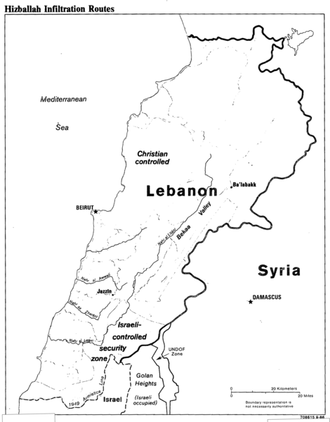
English: CIA map of southern Lebanon and Hezbollah infiltration routes into the Israeli-occupied security zone. |
|||
| תאריך יצירה | ||||
| מקור | Talking Points for the ADDI: Security Situation in Southern Lebanon. 29 September 1986. https://www.cia.gov/library/readingroom/docs/CIA-RDP91B00874R000100280011-0.pdf (ADDI: Associate Deputy Director for Intelligence) | |||
| יוצר | Central Intelligence Agency | |||
| אישורים והיתרים (שימוש חוזר בקובץ זה) |
|

היסטוריית הקובץ
ניתן ללחוץ על תאריך/שעה כדי לראות את הקובץ כפי שנראה באותו זמן.
| תאריך/שעה | תמונה ממוזערת | ממדים | משתמש | הערה | |
|---|---|---|---|---|---|
| נוכחית | 01:56, 27 בדצמבר 2017 | | 2,459 × 1,927 (794 ק"ב) | Streamline8988 | crop |
| 23:50, 26 בדצמבר 2017 |  | 3,356 × 2,560 (60 ק"ב) | Streamline8988 | {{Information |Description ={{en|1=CIA map of southern Lebanon and Hezbollah infiltration routes into the Israeli-occupied security zone.}} |Source =Talking Points for the ADDI: Security Situation in Southern Lebanon. 29 September 1986. http... |
שימוש בקובץ
הדף הבא משתמש בקובץ הזה:
שימוש גלובלי בקובץ
אתרי הוויקי השונים הבאים משתמשים בקובץ זה:
- שימוש באתר en.wikipedia.org
- שימוש באתר pnb.wikipedia.org
- שימוש באתר ur.wikipedia.org