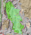
קובץ:Death Valley NP master map.png

גודל התצוגה המקדימה הזאת: 546 × 599 פיקסלים. רזולוציות אחרות: 219 × 240 פיקסלים | 437 × 480 פיקסלים | 853 × 936 פיקסלים.
לקובץ המקורי (853 × 936 פיקסלים, גודל הקובץ: 951 ק"ב, סוג MIME: image/png)
היסטוריית הקובץ
ניתן ללחוץ על תאריך/שעה כדי לראות את הקובץ כפי שנראה באותו זמן.
| תאריך/שעה | תמונה ממוזערת | ממדים | משתמש | הערה | |
|---|---|---|---|---|---|
| נוכחית | 23:59, 1 בינואר 2009 |  | 936 × 853 (951 ק"ב) | Mahahahaneapneap | Compressed |
| 03:30, 9 במרץ 2006 |  | 936 × 853 (1.22 מ"ב) | Mav | Map created by Daniel Mayer using data from the National Park Service [http://science.nature.nps.gov/nrdata/metadata.cfm?ID=16872 metadata] |
שימוש בקובץ
הדף הבא משתמש בקובץ הזה:
שימוש גלובלי בקובץ
אתרי הוויקי השונים הבאים משתמשים בקובץ זה:
- שימוש באתר af.wikipedia.org
- שימוש באתר bg.wikipedia.org
- שימוש באתר de.wikipedia.org
- שימוש באתר en.wikipedia.org
- שימוש באתר eu.wikipedia.org
- שימוש באתר fa.wikipedia.org
- שימוש באתר fr.wikipedia.org
- Parc national de la vallée de la Mort
- Wikipédia:Lumière sur/Mars 2005
- Wikipédia:Lumière sur/Février 2007
- Wikipédia:Lumière sur/Août 2007
- Wikipédia:Lumière sur/Parc national de la vallée de la Mort
- Wikipédia:Sélection/Géographie
- Wikipédia:Sélection/Amérique
- Portail:Information géographique/Sélection
- Wikipédia:Sélection/Désert
- Portail:Désert
- שימוש באתר hu.wikipedia.org
- שימוש באתר is.wikipedia.org
- שימוש באתר pl.wikipedia.org
- שימוש באתר zh.wikipedia.org