קובץ:Great Basin National Park map 2007.04.png

גודל התצוגה המקדימה הזאת: 679 × 600 פיקסלים. רזולוציות אחרות: 272 × 240 פיקסלים | 543 × 480 פיקסלים | 869 × 768 פיקסלים | 1,159 × 1,024 פיקסלים | 1,647 × 1,455 פיקסלים.
לקובץ המקורי (1,647 × 1,455 פיקסלים, גודל הקובץ: 649 ק"ב, סוג MIME: image/png)
| זהו קובץ שמקורו במיזם ויקישיתוף. תיאורו בדף תיאור הקובץ המקורי (בעברית) מוצג למטה. |
תקציר
| תיאור |
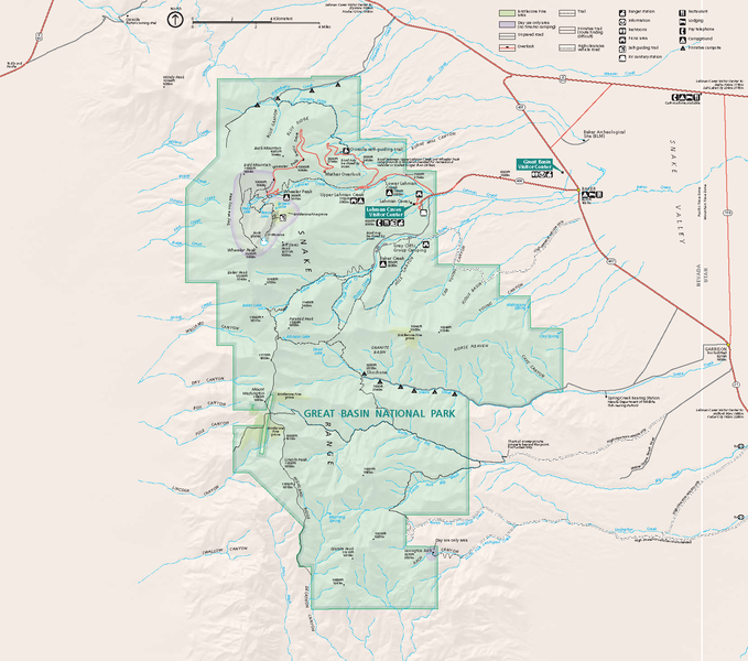
Official National Park Service map — of Great Basin National Park.
GRBAmap1.pdf |
| תאריך יצירה | |
| מקור | [1] |
| יוצר | National Park Service, Harpers Ferry Center |
| אישורים והיתרים (שימוש חוזר בקובץ זה) |
"The maps at this site are in the public domain. You may use National Park Service maps provided that you agree to assume complete legal responsibility for problems resulting from their use. Although National Park Service maps are easy to modify, understand that modifications can adversely alter the meaning and accuracy of the original data. Law prohibits you from using the National Park Service seal or claiming National Park Service endorsement with downloaded maps." [2] |
רישיון
| This image or media file contains material based on a work of a National Park Service employee, created as part of that person's official duties. As a work of the U.S. federal government, such work is in the public domain in the United States. See the NPS website and NPS copyright policy for more information. |
היסטוריית הקובץ
ניתן ללחוץ על תאריך/שעה כדי לראות את הקובץ כפי שנראה באותו זמן.
| תאריך/שעה | תמונה ממוזערת | ממדים | משתמש | הערה | |
|---|---|---|---|---|---|
| נוכחית | 07:48, 14 באוקטובר 2007 | | 1,455 × 1,647 (649 ק"ב) | Werewombat | == Summary == {{Information |Description = Official National Park Service map of en:Great Basin National Park, en:Nevada. Converted from PDF using Adobe Acrobat 7.0 Professional. O |
שימוש בקובץ
הדף הבא משתמש בקובץ הזה:
שימוש גלובלי בקובץ
אתרי הוויקי השונים הבאים משתמשים בקובץ זה:
- שימוש באתר cs.wikipedia.org
- שימוש באתר da.wikipedia.org
- שימוש באתר fr.wikipedia.org
- שימוש באתר hu.wikipedia.org
- שימוש באתר is.wikipedia.org
- שימוש באתר nl.wikipedia.org
- שימוש באתר pl.wikipedia.org
- שימוש באתר ru.wikipedia.org
- שימוש באתר tr.wikipedia.org