קובץ:Luxembourg plan Matteus Seuter.jpg
גודל התצוגה המקדימה הזאת: 715 × 600 פיקסלים. רזולוציות אחרות: 286 × 240 פיקסלים | 572 × 480 פיקסלים | 916 × 768 פיקסלים | 1,221 × 1,024 פיקסלים.
לקובץ המקורי (1,221 × 1,024 פיקסלים, גודל הקובץ: 381 ק"ב, סוג MIME: image/jpeg)
| זהו קובץ שמקורו במיזם ויקישיתוף. תיאורו בדף תיאור הקובץ המקורי (בעברית) מוצג למטה. |
תקציר
| אומן |
|
|||||||||||||||||||||||
| תיאור |
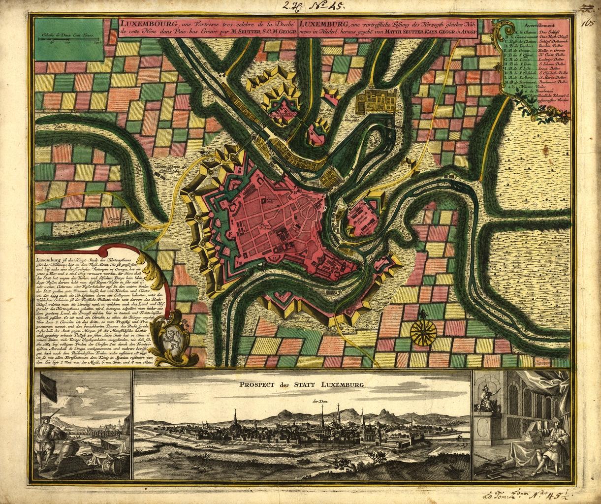
English: Map of Luxembourg City around 1730 by Matteus Seuter, a map publisher from Augsburg, Germany. It was published in his Grosser Atlas in 1734. |
|||||||||||||||||||||||
| תאריך יצירה | בסביבות 1730 | |||||||||||||||||||||||
| מקור/צלם | http://bibliodyssey.blogspot.com/2009/04/world-digital-library.html | |||||||||||||||||||||||

רישיון
|
עבודת אמנות דו-מימדית זו המוצגת בתמונה שוחררה לרשות הציבור בכל העולם בעקבות תאריך מותו של היוצר, או תאריך פרסום היצירה. לפיכך, תצלום היצירה גם הוא ברשות הציבור.
הודעה זו תקפה לגבי התצלומים שנוצרו בארצות הברית, בגרמניה ובמדינות רבות נוספות.
| ||||
היסטוריית הקובץ
ניתן ללחוץ על תאריך/שעה כדי לראות את הקובץ כפי שנראה באותו זמן.
| תאריך/שעה | תמונה ממוזערת | ממדים | משתמש | הערה | |
|---|---|---|---|---|---|
| נוכחית | 18:54, 28 בספטמבר 2010 | | 1,024 × 1,221 (381 ק"ב) | Ipigott | {{Information |Description={{en|1=Map of Luxembourg City around 1730 by Matteus Seuter, a map publisher from Augsburg, Germany. It was published in his Grosser Atlas in 1734.}} |Source=http://bibliodyssey.blogspot.com/2009/04/world-digital-library.html |A |
שימוש בקובץ
הדף הבא משתמש בקובץ הזה:
שימוש גלובלי בקובץ
אתרי הוויקי השונים הבאים משתמשים בקובץ זה:
- שימוש באתר en.wikipedia.org
- שימוש באתר es.wikipedia.org
- שימוש באתר fr.wikipedia.org
- שימוש באתר pl.wikipedia.org
- שימוש באתר pt.wikipedia.org