קובץ:Netherlands Drenthe location map.svg

גודל התצוגה המקדימה הזאת מסוג PNG של קובץ ה־SVG הזה: 516 × 599 פיקסלים. רזולוציות אחרות: 207 × 240 פיקסלים | 413 × 480 פיקסלים | 661 × 768 פיקסלים | 882 × 1,024 פיקסלים | 1,763 × 2,048 פיקסלים | 861 × 1,000 פיקסלים.
לקובץ המקורי (קובץ SVG, הגודל המקורי: 861 × 1,000 פיקסלים, גודל הקובץ: 87 ק"ב)
| זהו קובץ שמקורו במיזם ויקישיתוף. תיאורו בדף תיאור הקובץ המקורי (בעברית) מוצג למטה. |
תקציר
| תיאור |
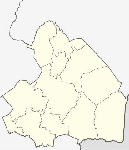
English: Location map of province Drenthe in the Netherlands
Equirectangular projection, N/S stretching 166 %. Geographic limits of the map:
Deutsch: Positionskarte von der Provinz Drenthe in den Niederlanden
Quadratische Plattkarte, N-S-Streckung 166 %. Geographische Begrenzung der Karte:
|
| תאריך יצירה | |
| מקור | נוצר על־ידי מעלה היצירה |
| יוצר | Erik Frohne |
| גרסאות אחרות | File:OSM - provincie Drenthe.PNG |
רישיון
אני, בעל זכויות היוצרים על היצירה הזאת, מפרסם אותה בזאת תחת הרישיונות הבאים:

|
מוענקת בכך הרשות להעתיק, להפיץ או לשנות את המסמך הזה, לפי תנאי הרישיון לשימוש חופשי במסמכים של גנו, גרסה 1.2 או כל גרסה מאוחרת יותר שתפורסם על־ידי המוסד לתוכנה חופשית; ללא פרקים קבועים, ללא טקסט עטיפה קדמית וללא טקסט עטיפה אחורית. עותק של הרישיון כלול בפרק שכותרתו הרישיון לשימוש חופשי במסמכים של גנו. |
הקובץ הזה מתפרסם לפי תנאי רישיון קריאייטיב קומונז ייחוס-שיתוף זהה 3.0 לא מותאם.
- הנכם רשאים:
- לשתף – להעתיק, להפיץ ולהעביר את העבודה
- לערבב בין עבודות – להתאים את העבודה
- תחת התנאים הבאים:
- ייחוס – יש לתת ייחוס הולם, לתת קישור לרישיון, ולציין אם נעשו שינויים. אפשר לעשות את זה בכל צורה סבירה, אבל לא בשום צורה שמשתמע ממנה שמעניק הרישיון תומך בך או בשימוש שלך.
- שיתוף זהה – אם תיצרו רמיקס, תשנו, או תבנו על החומר, חובה עליכם להפיץ את התרומות שלך לפי תנאי רישיון זהה או תואם למקור.
הנכם מוזמנים לבחור את הרישיון הרצוי בעיניכם.
היסטוריית הקובץ
ניתן ללחוץ על תאריך/שעה כדי לראות את הקובץ כפי שנראה באותו זמן.
| תאריך/שעה | תמונה ממוזערת | ממדים | משתמש | הערה | |
|---|---|---|---|---|---|
| נוכחית | 15:21, 27 במרץ 2009 | | 1,000 × 861 (87 ק"ב) | Erik Frohne | {{Information |Description={{en|1=Location map of province Drenthe in the Netherlands Equirectangular projection, N/S stretching 166 %. Geographic limits of the map: * N: 53.30° N * S: 52.60° N * W: 6.10° E * E: 7.10° E}} {{de|1=Positionskarte von d |
שימוש בקובץ
הדפים הבאים משתמשים בקובץ הזה:
שימוש גלובלי בקובץ
אתרי הוויקי השונים הבאים משתמשים בקובץ זה:
- שימוש באתר ba.wikipedia.org
- שימוש באתר bg.wikipedia.org
- שימוש באתר cs.wikipedia.org
- שימוש באתר de.wikipedia.org
- שימוש באתר de.wikivoyage.org
- שימוש באתר eo.wikipedia.org
- שימוש באתר es.wikipedia.org
- שימוש באתר frr.wikipedia.org
- שימוש באתר fr.wikipedia.org
- Assen
- Tynaarlo (commune)
- Tynaarlo (village)
- Hoogeveen
- Aa en Hunze
- Borger-Odoorn
- Coevorden
- Emmen (Drenthe)
- Eelde
- Meppel
- Midden-Drenthe
- Noordenveld
- Westerveld (commune)
- De Wolden
- Gasselterboerveenschemond
- Nieuw-Weerdinge
- Eext
- Annerveenschekanaal
- Eexterveenschekanaal
- TT Circuit Assen
- Erica (Drenthe)
- Amsterdamscheveld
- Balinge
- Barger-Compascuum
- Fille d'Yde