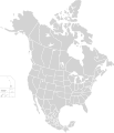
קובץ:North America second level political division 2.svg

גודל התצוגה המקדימה הזאת מסוג PNG של קובץ ה־SVG הזה: 512 × 596 פיקסלים. רזולוציות אחרות: 206 × 240 פיקסלים | 412 × 480 פיקסלים | 660 × 768 פיקסלים | 880 × 1,024 פיקסלים | 1,759 × 2,048 פיקסלים.
לקובץ המקורי (קובץ SVG, הגודל המקורי: 512 × 596 פיקסלים, גודל הקובץ: 132 ק"ב)
היסטוריית הקובץ
ניתן ללחוץ על תאריך/שעה כדי לראות את הקובץ כפי שנראה באותו זמן.
| תאריך/שעה | תמונה ממוזערת | ממדים | משתמש | הערה | |
|---|---|---|---|---|---|
| נוכחית | 04:51, 23 בנובמבר 2020 |  | 596 × 512 (132 ק"ב) | Ponderosapine210 | Added the prominent islands of Manitoulin (Ontario) and Isle Royale (Michigan) to the Great Lakes. |
| 02:07, 2 ביוני 2019 |  | 596 × 512 (130 ק"ב) | Fluffy89502 | added territories, made DC visible, adjusted mexican borders | |
| 15:23, 4 באפריל 2014 |  | 1,992 × 1,712 (270 ק"ב) | Lommes | made the borders between the mexican subdivisions the same size as their canadian / us counterparts. | |
| 02:23, 9 בדצמבר 2007 |  | 1,992 × 1,712 (327 ק"ב) | Lokal Profil | Code cleanup | |
| 10:55, 7 באוקטובר 2007 |  | 1,992 × 1,712 (342 ק"ב) | AlexCovarrubias | == Summary == {{Information |Description=Map of North America and its second-level political divisions. Canadian provinces, US and Mexican states. Canada, Mexico, United States. |Source=Canada and US map by Alan Rockefeller. Mexico map by Alex Covarrubias |
שימוש בקובץ
![]() אין בוויקיפדיה דפים המשתמשים בקובץ זה.
אין בוויקיפדיה דפים המשתמשים בקובץ זה.
שימוש גלובלי בקובץ
אתרי הוויקי השונים הבאים משתמשים בקובץ זה:
- שימוש באתר en.wikipedia.org
- שימוש באתר sk.wikipedia.org