קובץ:Rogue river access map.png
גודל התצוגה המקדימה הזאת: 298 × 598 פיקסלים. רזולוציות אחרות: 119 × 240 פיקסלים | 239 × 480 פיקסלים | 958 × 1,923 פיקסלים.
לקובץ המקורי (958 × 1,923 פיקסלים, גודל הקובץ: 577 ק"ב, סוג MIME: image/png)
| זהו קובץ שמקורו במיזם ויקישיתוף. תיאורו בדף תיאור הקובץ המקורי (בעברית) מוצג למטה. |
| תיאור |
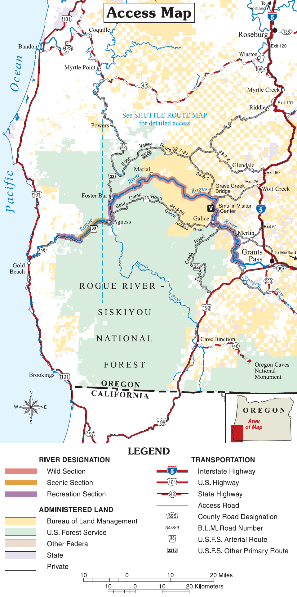
Map of the western course of the Rogue River, with access locations — in southwestern Oregon.
|
| תאריך יצירה | uploaded to wikipedia by w:User:EncMstr 17:16, 16 August 2006 |
| מקור | Rogue River Float Guide—w:Image:Rogue river access map.png |
| יוצר | Bureau of Land Management and US Forest Service |
This image is a work of the Forest Service of the United States Department of Agriculture. As a work of the U.S. federal government, the image is in the public domain.
|
היסטוריית הקובץ
ניתן ללחוץ על תאריך/שעה כדי לראות את הקובץ כפי שנראה באותו זמן.
| תאריך/שעה | תמונה ממוזערת | ממדים | משתמש | הערה | |
|---|---|---|---|---|---|
| נוכחית | 12:30, 29 בספטמבר 2007 | | 1,923 × 958 (577 ק"ב) | CarolSpears | {{Information |Description=Map of access points and route overview of Rogue River, Oregon from Rogue River Float Guide |Source=w:Image:Rogue river access map.png |Date= uploaded to wikipedia by w:User:EncMstr 17:16, 16 August 2006 |Author=Bureaa o |
שימוש בקובץ
הדף הבא משתמש בקובץ הזה:
שימוש גלובלי בקובץ
אתרי הוויקי השונים הבאים משתמשים בקובץ זה:
- שימוש באתר cs.wikipedia.org
- שימוש באתר de.wikipedia.org
- שימוש באתר en.wikipedia.org
- שימוש באתר es.wikipedia.org
- שימוש באתר nl.wikipedia.org
- שימוש באתר ru.wikipedia.org
- שימוש באתר www.wikidata.org