קובץ:South Africa Eastern Cape relief location map.svg

גודל התצוגה המקדימה הזאת מסוג PNG של קובץ ה־SVG הזה: 800 × 556 פיקסלים. רזולוציות אחרות: 320 × 222 פיקסלים | 640 × 445 פיקסלים | 1,024 × 712 פיקסלים | 1,280 × 889 פיקסלים | 2,560 × 1,779 פיקסלים | 1,298 × 902 פיקסלים.
לקובץ המקורי (קובץ SVG, הגודל המקורי: 1,298 × 902 פיקסלים, גודל הקובץ: 2.29 מ"ב)
| זהו קובץ שמקורו במיזם ויקישיתוף. תיאורו בדף תיאור הקובץ המקורי (בעברית) מוצג למטה. |
| תיאור |
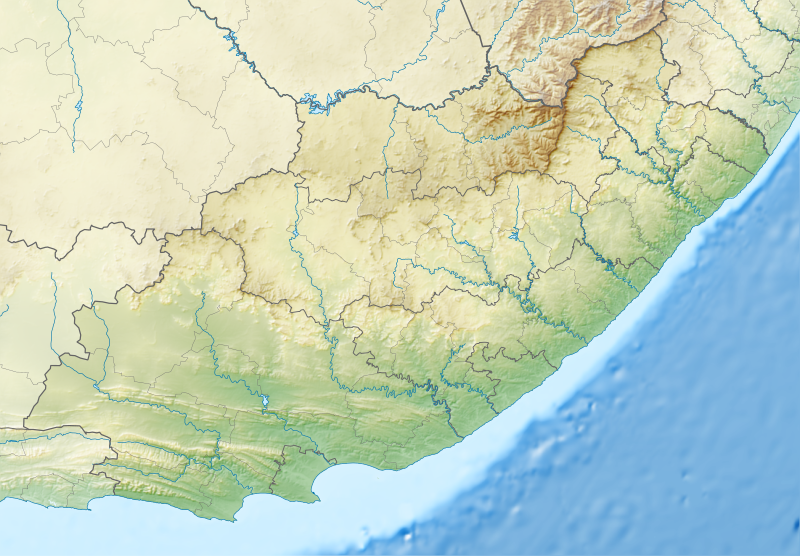
English: Relief location map of the Eastern Cape
Equirectangular projection, N/S stretching 117%. Geographic limits of the map:
|
| תאריך יצירה | |
| מקור |
|
| יוצר | Htonl |
| אישורים והיתרים (שימוש חוזר בקובץ זה) |
אני, בעל זכויות היוצרים על עבודה זו, מפרסם בזאת את העבודה תחת הרישיון הבא: הקובץ הזה מתפרסם לפי תנאי רישיון קריאייטיב קומונז ייחוס-שיתוף זהה 3.0 לא מותאם.
|
| גרסאות אחרות | File:South Africa Eastern Cape location map.svg |
היסטוריית הקובץ
ניתן ללחוץ על תאריך/שעה כדי לראות את הקובץ כפי שנראה באותו זמן.
| תאריך/שעה | תמונה ממוזערת | ממדים | משתמש | הערה | |
|---|---|---|---|---|---|
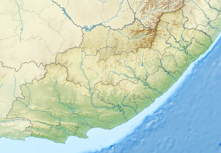
| נוכחית | 01:05, 5 בינואר 2013 | | 902 × 1,298 (2.29 מ"ב) | Htonl | Fix Lesotho masking |
| 00:48, 5 בינואר 2013 |  | 902 × 1,298 (2.29 מ"ב) | Htonl | {{Information |Description ={{en|1=Relief location map of the Eastern Cape Equirectangular projection, N/S stretching 117%. Geographic limits of the map: * N: 29.75° S * S: 34.5° S * W: 22.5° E * E: 30.5° E}} |Source ... |
שימוש בקובץ
הדפים הבאים משתמשים בקובץ הזה:
שימוש גלובלי בקובץ
אתרי הוויקי השונים הבאים משתמשים בקובץ זה:
- שימוש באתר af.wikipedia.org
- שימוש באתר ar.wikipedia.org
- שימוש באתר ban.wikipedia.org
- שימוש באתר bg.wikipedia.org
- שימוש באתר bn.wikipedia.org
- שימוש באתר ceb.wikipedia.org
- שימוש באתר de.wikipedia.org
- שימוש באתר en.wikipedia.org
- King Phalo Airport
- Chief Dawid Stuurman International Airport
- MTS Oceanos
- Ben Macdhui (Eastern Cape)
- Mountain Zebra National Park
- Mthatha
- Nahoon River
- South African PGA Championship
- Shamwari Game Reserve
- Port Alfred Airport
- Inkwenkwezi Private Game Reserve
- User:Xhantar/Sandbox2
- Mthatha Airport
- Doddington (East Indiaman)
- Kouga Dam
- Orange–Fish River Tunnel
- South African Masters
- Africa Open
- Great Fish River Nature Reserve
- Baviaanskloof Mega Reserve
- Commando Drift Nature Reserve
- East London Coast Nature Reserve
- Hluleka Nature Reserve
- Mpofu Nature Reserve