קובץ:Utupua or Edgecumbe Island 1968 62.5K map.jpg

גודל התצוגה המקדימה הזאת: 505 × 599 פיקסלים. רזולוציות אחרות: 202 × 240 פיקסלים | 405 × 480 פיקסלים | 647 × 768 פיקסלים | 863 × 1,024 פיקסלים | 1,726 × 2,048 פיקסלים | 4,049 × 4,803 פיקסלים.
לקובץ המקורי (4,049 × 4,803 פיקסלים, גודל הקובץ: 4.84 מ"ב, סוג MIME: image/jpeg)
| זהו קובץ שמקורו במיזם ויקישיתוף. תיאורו בדף תיאור הקובץ המקורי (בעברית) מוצג למטה. |
תקציר
| תיאור |
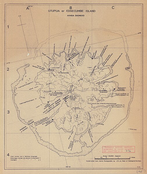
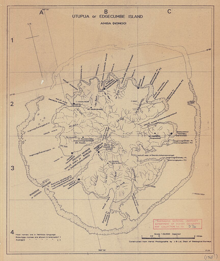
English: 1968 map of Utupua Island, Temotu Province, Solomon Islands, Melanesia, South Pacific Ocean |
| תאריך יצירה | |
| מקור | https://openresearch-repository.anu.edu.au/handle/1885/145246 |
| יוצר | Departments of Geological Surveys and Lands & Surveys (?) |
רישיון
This work created by the United Kingdom Government is in the public domain.
This is because it is one of the following:
HMSO has declared that the expiry of Crown Copyrights applies worldwide (ref: HMSO Email Reply)
|
 |
היסטוריית הקובץ
ניתן ללחוץ על תאריך/שעה כדי לראות את הקובץ כפי שנראה באותו זמן.
| תאריך/שעה | תמונה ממוזערת | ממדים | משתמש | הערה | |
|---|---|---|---|---|---|
| נוכחית | 16:23, 21 במרץ 2019 | | 4,803 × 4,049 (4.84 מ"ב) | Ratzer | User created page with UploadWizard |
שימוש בקובץ
הדף הבא משתמש בקובץ הזה:
שימוש גלובלי בקובץ
אתרי הוויקי השונים הבאים משתמשים בקובץ זה: