קובץ:Austria adm location map.svg

לקובץ המקורי (קובץ SVG, הגודל המקורי: 1,256 × 700 פיקסלים, גודל הקובץ: 183 ק"ב)
| זהו קובץ שמקורו במיזם ויקישיתוף. תיאורו בדף תיאור הקובץ המקורי (בעברית) מוצג למטה. |
תקציר
| תיאור |
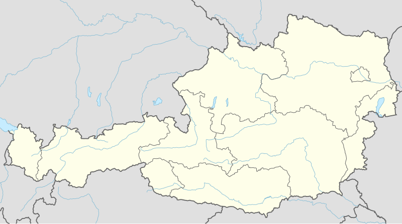
Deutsch: Positionskarte von Österreich
English: Location map of Austria
|
||||||||||||
| תאריך יצירה | |||||||||||||
| מקור |
נוצר על ידי מעלה היצירה, תוך שימוש:
|
||||||||||||
| יוצר | NordNordWest | ||||||||||||
| SVGהתפתחות | . Inkscape עם נוצרה ה גרפיקה וקטורית
|
||||||||||||

רישיון
Usage of this file with:

explanatory notes: Legally binding is only the full legalcode. For a free usage I recommend to respect the following licence conditions:
1. Provide my name as given above: NordNordWest,
2. a copy of, or the URI for, the applicable license: https://creativecommons.org/licenses/by-sa/3.0/de/legalcode,
3. the title of the work,
4. in the case of an adaptation, a credit identifying the use of the work in the adaptation.
This license and the rights granted hereunder will terminate automatically upon any breach by you of the terms of this license. Any of the above conditions can be waived if you get permission from the copyright holder. If you have questions or wish differing conditions, please contact me through nnwest or my discussion page ![]() t-online.de
t-online.de
- הנכם רשאים:
- לשתף – להעתיק, להפיץ ולהעביר את העבודה
- לערבב בין עבודות – להתאים את העבודה
- תחת התנאים הבאים:
- ייחוס – יש לתת ייחוס הולם, לתת קישור לרישיון, ולציין אם נעשו שינויים. אפשר לעשות את זה בכל צורה סבירה, אבל לא בשום צורה שמשתמע ממנה שמעניק הרישיון תומך בך או בשימוש שלך.
- שיתוף זהה – אם תיצרו רמיקס, תשנו, או תבנו על החומר, חובה עליכם להפיץ את התרומות שלך לפי תנאי רישיון זהה או תואם למקור.

היסטוריית הקובץ
ניתן ללחוץ על תאריך/שעה כדי לראות את הקובץ כפי שנראה באותו זמן.
| תאריך/שעה | תמונה ממוזערת | ממדים | משתמש | הערה | |
|---|---|---|---|---|---|
| נוכחית | 22:02, 2 בדצמבר 2014 | | 700 × 1,256 (183 ק"ב) | NordNordWest | == {{int:filedesc}} == {{Information |Description= {{de|1=Positionskarte von Österreich}} {{en|1=Location map of Austria}} {{Location map series N |stretching=150 |top=49.2 |bottom=46.3 |left=9.4 |right=17.2 }} |Source={{Own using}} * United States Na... |
שימוש בקובץ
יותר מ־100 דפים משתמשים בקובץ זה. הרשימה הבאה מראה רק את 100 הדפים הראשונים שמשתמשים בקובץ. ניתן לצפות ברשימה המלאה.
- אבנזה
- אגם וולפגנגזה
- אוברוורט
- אוניברסיטת קלגנפורט
- אוסטריה
- אייזנשטאדט
- אינסברוק
- אישגל
- אלטמינסטר
- אליפות אירופה בכדוריד 2010
- אנספלדן
- אסון קפרון
- באד אישל
- באד גאסטיין
- באד הופגאסטיין
- באד ויימסבאך-ניידהארטינג
- באדן (אוסטריה)
- בלודנץ
- בראונאו אם אין
- ברגנץ
- גונסקירכן
- גמונדן
- גראץ
- דויטשקרויץ
- דורנבירן
- האליין
- האלשטאט
- ואטנס
- ואכאו
- וולפסברג
- וולפסטאל
- ויידהופן אן דר איבס
- וינר נוישטאדט
- ולס (עיר)
- זולדן
- זלפלדן
- זלצבורג
- זמרינג
- טולן
- טירת אגנברג
- טירת לאודג
- טלפס
- טראון (עיר)
- יודנבורג
- לאובן
- לאונדינג
- לאנדק
- לוסטנאו
- ליינץ
- לינץ
- לקנבך
- מאוטהאוזן
- מאיירהופן
- מדלינג
- מחנה שטרסהוף
- מטרסבורג
- מיסטלבאך
- מירצצושלאג
- מלק
- מנזר מלק
- נויזידל אם זה
- נמל התעופה הבין-לאומי וינה-שווכאט
- נמל התעופה זלצבורג
- נמל התעופה של קלגנפורט
- סן אנטון
- סנקט יוהאן אים פונגאו
- סנקט יוהאן אין טירול
- סנקט פלטן
- סרפהאוס
- פוקינג (כפר)
- פוקינג (מחוז לינץ)
- פושל אם זה
- פילאך
- פלדקירך
- פלדקירכן אין קרנטן
- פלוגה ה', רגימנט 506, הדיוויזיה המוטסת ה-101 (מלחמת העולם השנייה)
- פלכאו
- פראונקירכן
- קוברסדורף
- קונסטהאוס גראץ
- קופשטיין
- קיצביל
- קלגנפורט
- קלטנבאך
- קליינרייפלינג
- קפפנברג
- קפרון
- קרמס אן דר דונאו
- קרנונטום
- רד בול רינג
- רוהרבאך
- ריד אים אינקראיס (מחוז)
- רין (כפר)
- רכניץ
- שוואץ
- שטוקראו
- שטייר
- שפאו אם וילדן קייזר
- שפיטל אן דר דראו
- תרניץ
ישנם דפים נוספים שמשתמשים בקובץ זה.
שימוש גלובלי בקובץ
אתרי הוויקי השונים הבאים משתמשים בקובץ זה:
- שימוש באתר ab.wikipedia.org
- שימוש באתר ast.wikipedia.org
- Amstetten
- Viena
- Minihof-Liebau
- Burgruine Starhemberg
- Burgruine Aggstein
- Castiellu d'Ambras
- Donnerskirchen
- Selva de Bohemia
- Salzburgu
- Fugging
- Graz
- Innsbruck
- Linz
- Patrimoniu de la Humanidá n'Austria
- Palaciu Belvedere
- Estadiu Ernst Happel
- Universidá de Viena
- Universidá d'Economía de Viena
- Circuitu d'Österreichring
- Eisenstadt
- Klagenfurt
- Sankt Pölten
- Bregenz
- Módulu:Mapa de llocalización/datos/Austria
- Leibnitz
- Módulu:Mapa de llocalización/datos/Austria/usu
- Fraxern
- Bañu central de Viena
- Berg und Löwenherz
- Aeropuertu de Graz
- Aeropuertu d'Innsbruck
- Aeropuertu de Klagenfurt
- Aeropuertu de Linz
- Catedral de San Esteban de Viena
- Ferrocarril de Mariazell
- שימוש באתר as.wikipedia.org
- שימוש באתר azb.wikipedia.org
- שימוש באתר ban.wikipedia.org
- שימוש באתר bh.wikipedia.org
- שימוש באתר bn.wikipedia.org